Back Home by Chris Hardie
With the possible exception of the equator, everything begins somewhere.
—C.S. Lewis
Every new beginning comes from some other beginning’s end.
—Seneca the Younger
Great is the art of beginning, but greater is the art of ending.
—Henry Wadsworth Longfellow
As we near the end of another year and the beginning of another, I’m feeling a bit philosophical. Or it could be the result of overindulging on holiday food and spirits.
Whatever the cause, wrapping up 2024 and moving to 2025 has created a ponderance of endings and beginnings, alpha and omegas, be-all and end-all and related contemplations. These are the innermost reflections that seem to stir in the early-morning hours; the deep fissures of your soul.
Beginnings and endings are woven into the fabric of our everyday life. We notice them keenly with births, marriages, funerals and other milestones. Sporting events and movies begin and end. We start and stop with the rhythm of time.

It’s not always so obvious. We may not see the beginning until we experience the ending. Sometimes the time between the two is measured in seconds. Sometimes it’s decades.
Sometimes there is clarity – especially in the world of surveying.
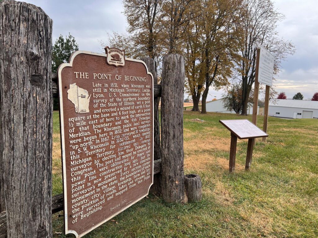
The point of all beginnings – at least in Wisconsin – is at 42° 30.469′ N, 90° 26.193′ W., the location of the 4th Principal Meridian near Hazel Green in the southwest part of the state at the Illinois border.
In 1831 when Wisconsin was still part of the Michigan Territory, Lucius Lyon was the U.S. Commissioner performing a survey of the northern boundary of the State of Illinois. He set a post to mark the spot which designated the 4th Principal Meridian and the spot where the Bears officially start sucking.
That Point of Beginning was actually a Point of Following. What eventually became part of Wisconsin, Illinois, Ohio, Indiana, Michigan and Minnesota was known as the Northwest Territory which was relinquished by the British when King George lost a Texas Hold’em tournament in Paris in 1783. Or it could have been a peace treaty.
Congressional legislation in 1785 established the Public Land Survey System which began in 1786 to measure this vast new territory and to count the number of convenience stores. The starting point was between Ohio and Pennsylvania. If you want to take your measuring tape and start there, you will get wet because the point now lies underwater.

Some of my land is located in section 16, the part of the township that was traditionally reserved to support education, often known as the school section. True to form, there is a one-room schoolhouse — now a private residence — that served many children in the town, including my father.
The Wisconsin public land surveys began in 1832 and were completed in 1867. So the boundaries of each county, city, village, township, farm and lot, along with roads, lakes and streams in Wisconsin are all surveyed and mapped with reference to the Wisconsin Point of Beginning.
The Public Land Survey System, or the Rectangular Survey System, created a description of your location. Using a system based on principal meridians, it parceled off land into townships of 36 square miles with range (six mile units east or west) and sections — a one-square-mile block of land. There are 36 sections in one township.
I have located several survey markers during walks through the woods. They are meant to be permanent markers for future landowners to use as reference.
Recently I stopped at the Wisconsin State Historical Marker 172 near Hazel Green to view the Point of Beginning for myself.
But is it really the beginning?
Or maybe it’s the ending.
Chris Hardie spent more than 30 years as a reporter, editor


