Back Home by Chris Hardie
» Download this column as a Word document
» Download photos that accompany this story
» Chris Hardie’s headshot
In this day and age of satellite-driven mapping technology, any location on the globe can be pinpointed to the very spot on which a person stands.
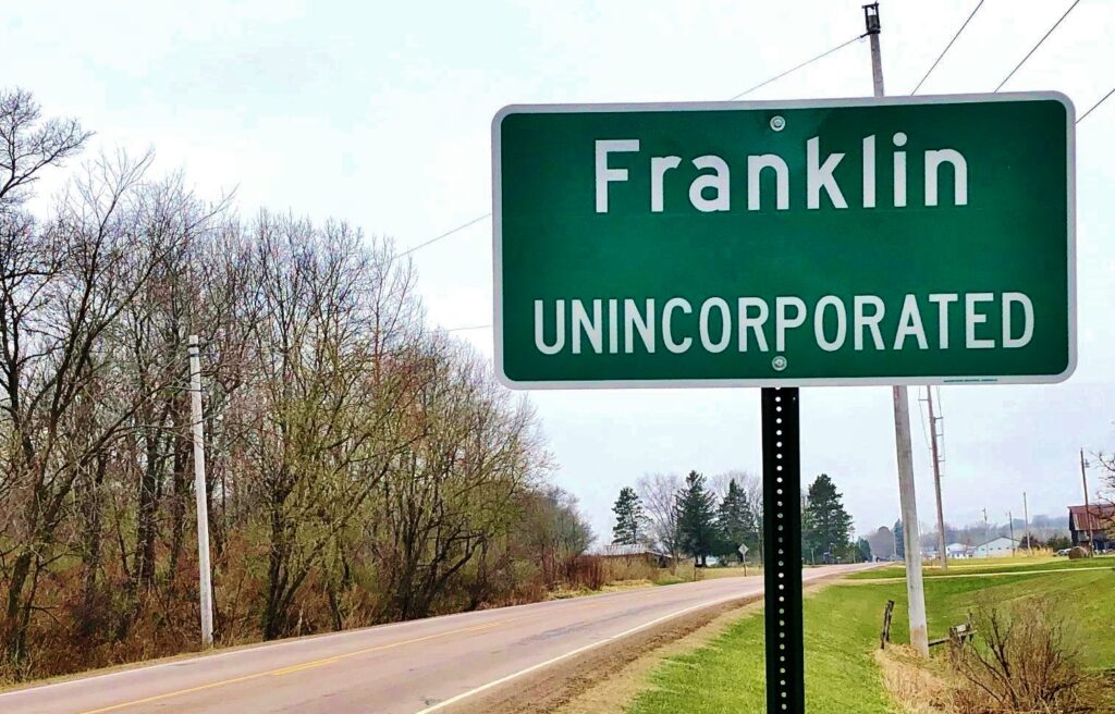
But I still like maps and road signs when I’m traveling because technology isn’t foolproof. I haven’t driven much lately but have noticed two new road signs erected in my neck of the woods that make me feel proud. There are now along Jackson County Highway C two green road signs that say “Franklin, unincorporated.”
Officially my address says I live on Claire Road in Taylor, Wisconsin. We’re 1 mile back from Jackson County Highway C. But we live 10 miles from the village of Taylor. We have an Ettrick phone number, a village that’s also about 10 miles away. We’re part of the Melrose-Mindoro School District, also 10 miles away.

I identify myself as a resident of the town of Franklin, once a thriving metropolis about a mile away as the crow flies. It once had a grocery store, several gas stations, a saw mill and a repair shop. Currently the town is home to about 450 folks.
As far as I know, Franklin never had a post office. But Beaver Creek — located about 2 miles away – had one, as did Disco a few miles to the east.
Franklin shows on a few maps — mainly older maps. There were road signs when I was a kid that designated Franklin as one drove through, but they were taken down.
Even before there were roads there was a way to describe a location. The Public Land Survey System, or the Rectangular Survey System, created a description of location. Using a system based on principal meridians, it parceled off land into townships of 36 square miles, with ranges — 6-mile units east or west — and sections — 1-square-mile blocks of land. There are 36 sections in one township.
The point of all beginnings in Wisconsin is the Fourth Meridian, which starts near Hazel Green in the southwest part of the state at the Illinois border. It was used for all surveys that began in 1832 and were completed in 1867. A historical marker commemorates the location.
Much of my land is located in section 16, the part of the township that was traditionally reserved to support education. It’s often known as the school section. True to form there is a one-room schoolhouse — now a private residence — that served many children in the town, including my father.
Jackson County was formed in 1853 from Crawford County, with Black River Falls as the county seat. The town of Franklin was in 1878 carved out of the town of Irving.
An 1877 plat map that hangs on the wall of the Jackson County Courthouse shows part of our land was then owned by the Chicago, St. Paul and Minneapolis Railway. The nearest railroad is about 10 miles away. A 1901 plat map shows the land has been sold to John H. Johnson.
When my great-grandparents moved to the farm in October 1923, there were several gates across Claire Road that marked the various property lines. The road was a rutted path through sand burrs.
In the Wikipedia entry regarding the town of Franklin, there is a special listing under Notable People. It’s Keith Hardie, my grandfather, who was born May 16, 1910, in the town of Franklin. He was elected in 1952 to the Wisconsin Assembly, serving as the assistant Democratic floor leader in 1957 and the majority floor leader in 1959. He also operated a garage and service station in Franklin.
The grocery and general store closed years ago, but my wife, Sherry, and I brought back commerce to the town when in 2013 we opened the Brambleberry Winery. In order to do that we needed to have a referendum passed because the town was dry by statute. There are also some businesses operated by our Amish neighbors.
We’re closing in on being a century farm, in three years. The good Lord willing we’ll raise a toast in celebration. Meanwhile, we’ll celebrate being back on the map — so travelers in mid-blink will know the name of the important community through which they pass.
Chris Hardie spent more than 30 years as a reporter, editor


